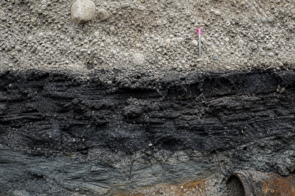
There are places in northern Saskatchewan where a wheel leaves a mark in muskeg and the mark remains after the machine is gone.
Not as a complaint about scenery.
Not as a complaint about difficult terrain.
A rut changes the elevation at which water gathers.
Water changes thaw.
Thaw changes whether the next loaded machine has a surface to travel on.
The first alteration is small.
The consequence is not.
In the boreal and muskeg terrain around the Athabasca Basin, a tracked machine can cross ground that will not carry a wheeled haul truck. That is not a choice between a rugged machine and a fragile one. It is a response to ground pressure and seasonal bearing capacity.
The difference reaches much further than the vehicle making the first crossing.
It reaches the route, the road, the loading tool, the number of trucks that can be dispatched, the spare fleet, the fuel plan, the maintenance shift, the last day on which equipment can leave, and the work that cannot begin because the ground has not yet become a road.
A truck is said to have a payload.
It does.
Caterpillar rates its 797F at 363 t nominal payload. But that number describes a truck under stated conditions. It does not create a running surface beneath it.
In northern ground, the road is part of the fleet.
The ground receives the load first
Muskeg is treated as scenery.
Dark water, peat, low trees, a place that makes access inconvenient.
That is the wrong scale of description.
A route across peat, wet ground and patchy permafrost is a load-bearing system with a thermal history.
It has to receive force.
This is why the tracked-machine fact matters.
It does not mean every tracked machine can cross every muskeg. It means the nominal capacity of a wheeled truck is conditional on a ground-pressure and bearing-capacity case a catalogue does not contain.
A truck can be correctly specified for payload, gross mass, tire capability and power, then be unusable at the first weak section of its route.
The specification document says the same thing in another vocabulary.
Road geometry is a hard filter.
Loaded grade.
Rolling resistance.
Minimum curve radius.
Stopping and retarding capacity.
Running-surface condition.
Berm arrangement.
Dump geometry.
Maintenance access.
The payload rating is a starting condition, not a road approval. Caterpillar’s own note requires tire limits to be checked with the tire supplier for the actual truck and body configuration.
The truck nameplate does not carry the truck.
The northern-corridor record begins with the same refusal.
An ice road, a packed-snow route, a temporary mat crossing and an all-season gravel alignment transfer different forces to water, peat and frozen ground.
The service has to be named first.
Fuel, food, drill supplies, crews and backhaul.
Traffic type and total loads.
Camp and water needs.
Freeze-up, break-up and emergency requirements.
A road is too vague.
So is a truck.
Winter access expires
Frozen travel can spread load over snow and ice and avoid summer rutting. It can also fail if traffic begins before adequate frost.
The route is not open because a calendar says winter has arrived. It is open when field conditions meet an agreed threshold.
The case material calls this a go/no-go threshold.
A pre-agreed field condition that allows, limits or stops an activity. Before hauling begins, the operator verifies frost, ice, water levels and route condition. A route monitor can reduce loads, move traffic to another alignment, or suspend travel.
Those are dispatch decisions, not merely environmental observations.
The relevant places are exact in kind even where local design values remain to be established.
Deep peat.
Lake outlets.
Shrub tundra.
Known overflow channels.
Terrain where clearing exposes warm permafrost.
Each is a section where route availability has to be confirmed rather than inferred from a road centreline.
The corridor case uses the Inuvik to Tuktoyaktuk highway as a scale contrast between seasonal and permanent access. The comparison does not make a northern Saskatchewan mine route a highway. It shows the difference between a service requirement and an assumed infrastructure answer.
A short route can still be a seasonal system whose limiting date is not the first haul but the final safe demobilization.
This is where a fleet calculation changes character.
The usual cycle is loading, loaded travel, dumping, empty return and delays. The number of productive trucks depends on that whole cycle, with allowances for queues, refuelling, maintenance and road variability.
Add trucks and shovel utilization can rise, but only until congestion at the loader, dump or crusher becomes the binding constraint.
On a seasonal route, a further constraint arrives before the queue. There may be no legal or safe cycle to perform.
The fleet is not a row of trucks.
It is a timetable made out of ground.
Heat becomes an availability problem
The tempting mistake is to assume cold air protects frozen ground automatically.
It does not.
Snow cover, vegetation removal, water ponding and gravel embankment can warm ground while air temperatures stay low.
At Dempster Highway sites, annual ground temperatures beside embankments ran 0.5 to 2.5 °C higher than at control sites.
That is not an Athabasca Basin design value.
It is a measured northern example of a mechanism that has to be checked locally before a route, an embankment or a maintenance interval is treated as fixed.
The mechanism is severe because it compounds.
A blocked culvert diverts water onto an ice-rich shoulder.
The water deepens thaw.
Settlement follows.
The settlement captures more water.
The original drainage defect has become a change in the running surface, and then a restriction on traffic.
Road maintenance is therefore not a support service appended to hauling.
It is a component of productive capacity.
Drainage inspection, crossing maintenance, snow and ice placement, weak-area monitoring and repair consume crew, equipment and time.
They also decide whether loaded travel can continue.
This is why an hour of mechanical availability is not necessarily an hour of fleet availability.
A truck can be mechanically sound.
Its tires can meet the approved limit.
Its body can be correctly matched to the material. It is still not productive while a crossing is being repaired, a route monitor has cut the load, water has reached a trigger, or the seasonal corridor is closed.
The equipment record offers another useful distinction.
A shovel makes a bucket pass.
A truck makes a haul cycle.
A large face shovel can be specified by payload, bucket volume, digging height and reach, and none of those values says how much material arrives at a crusher if the road becomes the constraint.
Bucket capacity is geometry, density and fill factor.
Fleet capacity is that calculation plus time.
Northern fleet capacity is that calculation plus time plus a surface whose capacity changes while the fleet is operating.
The useful rating is conditional.
A route selects a maintenance burden
The northern landscape is not empty ground between a camp and a deposit. Large parts of the Taiga Plains and Boreal Plains are wetland by national inventory.
Those figures do not select an alignment at the Athabasca Basin. They explain why wet-ground avoidance, drainage continuity and field inspection belong in the design basis rather than the restoration memo.
A route that saves distance can require more crossings, more water control and more repair work than a longer route on mineral ground. A bog that bears a temporary crossing under confirmed frost is not the same as a fen carrying flowing water under snow.
That distinction cannot be made reliably from one satellite image.
So the first consequential choice is often the operating season, not the line on a map. The next is the evidence needed to decide which sections cannot be used until field confirmation.
A project description recording kilometres, crossings, temporary work areas, camps, fuel storage, water withdrawal and closure method is not administrative overhead.
It is the beginning of an access specification.
The governing conditions then have to become executable.
Protect wetlands needs a field boundary, a no-go map, a thaw or standing-water trigger, a person authorized to stop traffic, a repair method and a record. Monitor permafrost without a thermal or settlement trigger and a response owner is evidence collection, not control.
This is a hard lesson for equipment procurement.
A vendor can supply the rated engine power.
The vendor cannot supply the field authority that turns a vehicle around when a route is no longer acceptable.
The machine is purchased once.
The operating permission is renewed every day.
The window has competitors
The narrow season has to contain more than production. Construction, commissioning, route inspection, refuelling, repairs, weather delays, emergencies and demobilization all compete for the same frozen interval.
Fire makes the point without requiring a prediction.
Canada averages roughly 2.1 million ha burned each year across several thousand wildland fires. That is context, not a forecast for a particular mine route.
It is enough to make smoke, access interruption, water and fuel information, and post-fire drainage change ordinary operating contingencies rather than exotic ones.
The corridor operator may share access, water, fuel and crew information with authorities if wildfire threatens the route.
The operator does not self-deploy into fire suppression.
That division of authority matters, because a project schedule cannot decide which response has priority.
The regulatory layer has a similar structure.
A federal impact assessment can run for most of a year, with a decision phase after substantially longer preceding work. Those intervals are not a schedule template for northern Saskatchewan.
They demonstrate where the design leverage is.
Early.
Define alternatives, establish baseline conditions, and write controls the field can actually execute.
The answer is not to make every road permanent. An all-season gravel alignment transfers a different thermal and hydrologic burden to the ground than a winter route. A permanent option and a seasonal option are different operating systems, with different commitments to water movement, maintenance, restoration and access.
Neither is a neutral default.
What has the ground not told the fleet?
The unanswered quantities are the ones that should govern the final selection.
Peat depth.
Ice content.
Local permafrost distribution.
Freeze-up and break-up timing.
Precipitation.
Storm response.
Fire exposure.
Bearing-capacity thresholds.
Route geometry.
Tire approvals.
The thermal response of each proposed crossing.
The word available has more than one owner.
A machine can be available in the maintenance system and unavailable to the mine. A route can be present in the layout and unavailable to traffic.
A payload can be permitted by the body and unavailable to the tires, the road or the season. A production target can be physically reachable during only a fraction of the window the spreadsheet assumed.
Those are not failures of equipment specification.
They are the conditions specification is supposed to absorb.
The Athabasca Basin is the address of the problem, not its boundary. Any mine crossing wet, thaw-sensitive or seasonally weak ground faces the same inversion.
The machine is usually chosen first, because it arrives in a catalogue as a complete object. The access environment arrives as weather, water, vegetation, ground ice, drainage and time.
It looks less like an object.
It is the larger machine.
First comes the physical fact.
A load meets ground that may support it today and not tomorrow.
Then come the tracks and tires, the route and embankment, the drainage checks, the reduced loads, the extra maintenance crew, the queue at the loader, the delayed fuel delivery, the unused truck, the early demobilization, and the capital tied to a fleet that cannot reach the work.
The first-order effect is easy to name.
The ground carries less.
Access decides the rest.