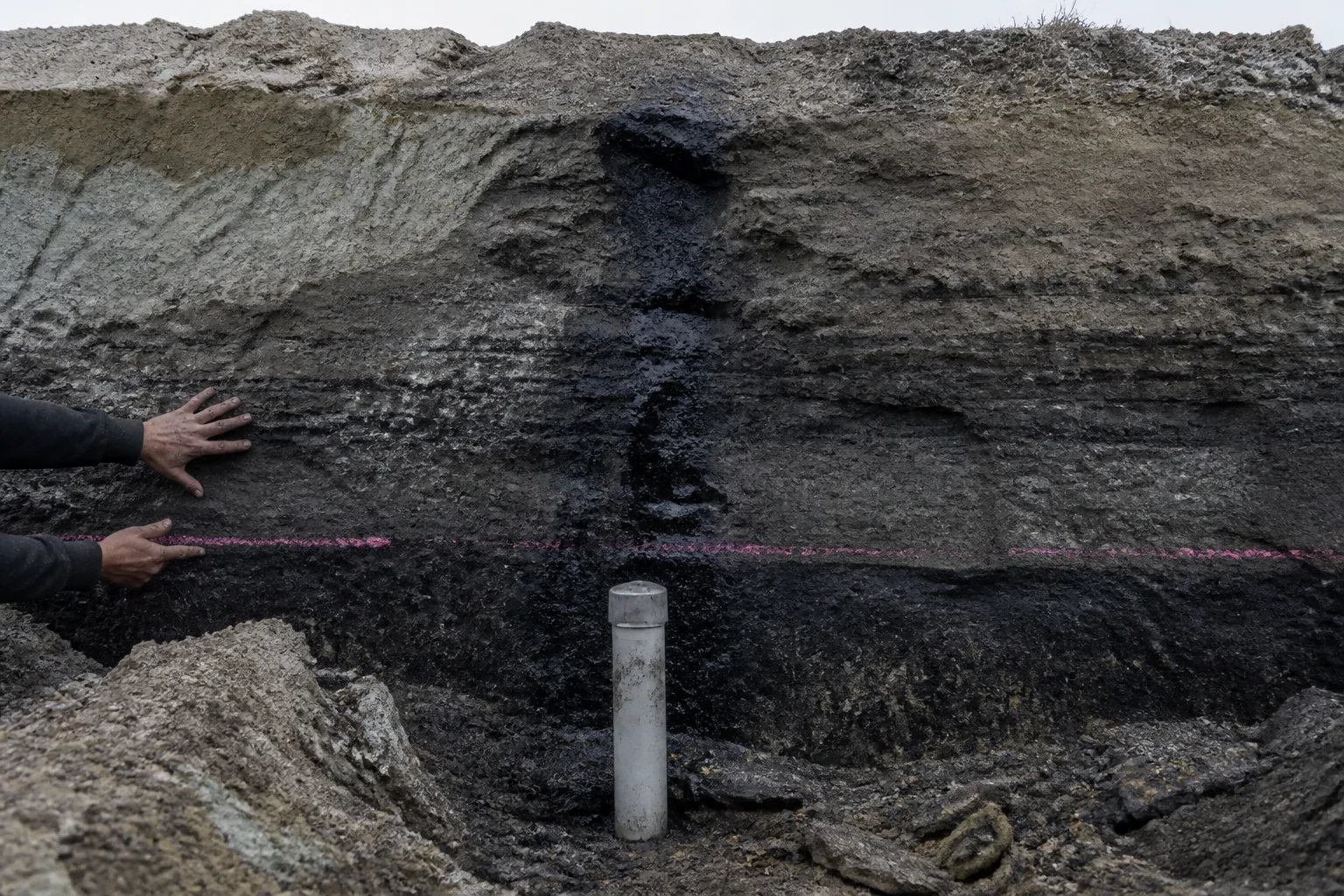
At the McClean Lake uranium-mill area, a baseline well can hold water that has not yet been asked to explain anything.
It has a level.
It has chemistry.
It has a location fixed in ground that has not yet been disturbed by the project being assessed.
It also has a time.
This is not a neutral snapshot.
It is a future argument, prepared before the argument has a subject.
If later sampling finds a different water level or a different chemical result, the well is not being consulted for scenery. It is being asked whether the project changed the condition it recorded. The answer depends on what was measured, where, when, by what method, against which reference, and for what predicted pathway.
A baseline is assumed to describe a place before development.
It does not.
A useful baseline designs a comparison that has to survive development.
A condition has to be revisitable
Saskatchewan’s assessment flow begins with a conceptual model. Sources of change, pathways through air, land and water, receptors, study boundaries, seasonal conditions, and the existing pressures that should not be assigned to the mine. Only then does field evidence become a baseline programme.
That ordering is severe.
It says no measurement is meaningful merely because it is environmental.
Water level without a defined receptor is an observation. Chemistry without a plausible pathway is an inventory. A wildlife record without timing or a study boundary is a sighting.
All may be useful.
None of them necessarily supplies a future comparison.
Provincial guidance calls for a comparable condition set for each monitored receptor. It names baseline locations, timing, methods, analytes or observations, detection limits where applicable, and the rationale for reference areas.
That is not a filing preference. It is the minimum architecture by which a later result can be made commensurable with an earlier one.
The word comparable is doing the hard work.
A result from the same well can still fail the comparison. If the sampling procedure changed. If the laboratory basis is unknown. If the season changed without a record of natural variation. If the well never represented the pathway the project could affect.
A number is not automatically an observation of the same thing.
The well records water.
The baseline records a claim about water.
The boundary precedes the disturbance
Before a consultant chooses a monitoring station, a proposal has to say what will be built and operated, where disturbance lies, what enters and leaves the system, how construction proceeds, what alternatives were considered, and what environmental interactions are foreseeable.
Saskatchewan’s published screening framework applies a set of development tests rather than a production-tonnage threshold. Possible effects on unique, rare or endangered features. Substantial provincial-resource use that pre-empts another use.
Unregulated wastes.
Widespread public concern.
New resource technology capable of significant change. Significant effects, or further developments likely to have them.
The list is a test of connection. It is not a way to make a project disappear by dividing it into contracts.
Roads, power, water infrastructure and later expansions are not background to the mine. They can create the combined footprint and the pathways screening has to see. A project description that leaves them as later details can make a baseline exact about the wrong boundary.
This is where assessment becomes land use.
A surface plan turns a broad subsurface interest into a surveyed disturbance footprint. Pad, road, pipeline, utility route, construction zone, topsoil handling, restoration endpoint.
Saskatchewan highway guidance makes the point physical. An approach has a specified top width of 8 to 11 m, with location, slope and drainage requirements. A narrow access decision can change field fragmentation, ditch drainage, sight lines, and the possibility of a shared entrance.
The mineral interest is not the footprint.
Nor does mineral tenure settle the footprint. Where surface and subsurface rights are separated, roads, work areas, utility connections, temporary disturbance, restoration and compensation remain their own decision. The province describes its Surface Rights Board of Arbitration as a last-resort forum where an owner or occupant and an operator cannot agree.
The resource below does not erase the land above.
Alternatives preserve what mitigation cannot
The impact statement connects a selected component to an activity, a pathway, a predicted direction and magnitude of change, mitigation, residual effect, uncertainty, and proposed follow-up. Each term belongs in the record because each can fail independently.
Alternatives come before mitigation.
A route can be shifted. A water source can be changed. A footprint can be reduced, or a candidate location declined.
To mean anything, the alternatives have to be compared against a common purpose, footprint and effect measure. Otherwise the preferred alternative has been allowed to choose its own test.
Mitigation is a different thing. It concerns the activity that remains after the choice.
A control on construction.
A facility condition.
An operating practice.
A monitoring response.
Mitigation can reduce an effect. It cannot recreate the receptor condition a different location would have left untouched.
This is why a baseline has a temporal edge.
Once clearing, excavation, traffic, water withdrawal or discharge begins, the disturbed place is no longer available as its own pre-disturbance reference. A later survey can find a condition. It cannot turn the altered condition back into the one that was never measured.
Reference areas help.
They are not time machines. Provincial guidance requires a rationale for them precisely because another place is only a comparison if it shares the relevant conditions while staying outside the proposed pathway. Similar-looking ground can have another hydrology, access pattern, use history or receptor community.
The missing record is often not a datum.
It is the design that would have made the datum answerable.
Approval distributes a prediction
If screening produces a ministerial determination, the proponent conducts an assessment and has a statement approved before proceeding to the remaining permits.
The approval is consequential.
It is not the whole project in legal form.
In the Yancoal solution-potash example in Saskatchewan, several follow-on gates sit before construction can proceed as proposed. Construction and operating approval under mining regulations.
A water-allocation licence.
A mining-well licence.
Approval of decommissioning and reclamation planning with financial assurance.
A different mine has a different combination. The lesson is the handoff.
An impact-statement commitment is broad evidence until it becomes a facility condition, a water authorization, a well-licence term, a construction hold point or an operating instruction. Each translation names an owner, a due date, a field action, a data record and a route for verification.
A commitment without that chain is language awaiting a system.
Saskatchewan’s mine-permit paths run from construct or alter, through decommissioning plan and fund, operate, decommission and reclaim, temporarily close, to release from decommissioning and reclamation requirements.
Stopping production is therefore not a clean exit from the boundary created at assessment. Temporary closure changes monitoring, maintenance and reporting. Release requires evidence that the regulatory end state has been met.
By then the baseline has become a land-use limit. It helps establish what condition has to be watched, what change can be attributed, what mitigation has to hold, and what end state needs demonstrating.
A record is evidence only when it can act
During operations, sampling has to stay connected to permit limits, baseline ranges and predicted effects. The useful record carries location, time, method, instrument or laboratory basis, quality checks, exceedance response, and the condition it belongs to.
A table of results without those links is accounting, not compliance evidence.
Under one federal decision-statement model, follow-up results are due no later than 3 months after each reporting year. The programme identifies the prediction or mitigation being tested, the locations and frequency, the change levels that trigger more mitigation, and quantifiable endpoints for ending follow-up.
It exists to learn whether a prediction held, whether mitigation was inadequate, or whether an unrelated change explains the observation.
Different rule systems place different edges around that evidence. The federal Metal and Diamond Mining Effluent Regulations include a 50 m³ per day final-discharge flow trigger among their application tests. A final discharge point is where the operator no longer controls effluent quality.
Put that point in the wrong place and the monitoring architecture describes control that no longer exists.
For uranium mines and mills, the Canadian Nuclear Safety Commission runs a separate lifecycle licensing system alongside provincial assessment and mine permits. Its operating licences are usually issued for 10 to 20 years. That interval does not replace the original assessment. It creates another occasion to test whether environmental evidence and controls remain adequate.
The site is not protected by a conclusion.
It is governed by the records that can force the conclusion to change.
What don’t we know?
The question is not whether a baseline well can be sampled accurately.
It can.
The question is whether the baseline captured the range that matters.
Did it observe natural variation over the relevant seasons? Did it include every receptor through which an effect could be expressed? Did its reference area share the relevant conditions while lying outside the project pathway? Did the project description include the later road, water source, utility route or expansion that will determine the actual disturbance?
That last question is the one that most often goes unasked.
A baseline may have been carefully collected for a proposed project that never existed in that form. Capacity, location, water source and waste stream can change. If the change is not controlled back through screening, assessment and permits, the original record becomes precise evidence for a superseded design.
Nor does the absence of an observed change settle causation. A receptor may not have been measured at the right location or time. A pathway may have been misidentified. An analytical method may not have resolved the relevant constituent. Or the project may truly have caused no detectable change.
Those are different histories that produce the same quiet table.
This is an inverse problem, and it unfolds in public time.
Later evidence has to infer whether a present condition arose from a project, from natural variability, from another activity, or from a measurement scheme that failed to see the relevant difference. Better models and independent records can constrain the answer. They cannot manufacture the pre-alteration condition that was not preserved.
The first record is an obligation
There are places where a well casing, a survey line or a reference plot looks like preliminary work.
It is not.
It is the point at which an assessment decides what the future will be allowed to know about the past.
Land-use decisions then make that knowledge spatial. They distinguish a protected or conditioned parcel from a development option, a surface route from a subsurface right, a construction footprint from a retained access corridor. Saskatchewan’s Statements of Provincial Interest identify common-interest areas including biodiversity, mineral exploration and development, transportation, shore land and source-water protection.
The planning record exists because a local footprint can carry effects beyond the parcel that first proposed it.
The physical alteration can be small. An approach a few metres wide.
A well.
A cleared route.
A discharge point.
The evidentiary alteration can be much larger. Once the pre-project condition is overwritten, the later argument begins with less of the thing it needs to prove.
The baseline is not an environmental portrait.
It is the boundary a project must later prove it did not cross.