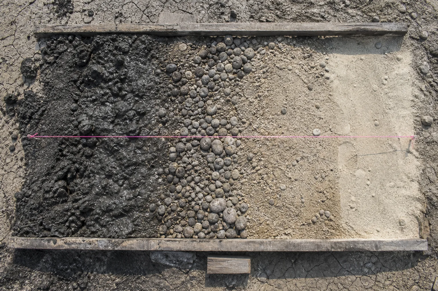
There are boulders near Prince Albert that did not belong there before the ice put them down.
Not metaphorically.
Not as a vague claim that the landscape has been disturbed.
Saskatchewan’s glacial record includes erratic boulders carried hundreds of kilometres before direct ice deposition. A cobble on the surface can be a piece of another bedrock province, delivered by a moving sheet of ice and left above ground that never made it.
It is a transport record.
That matters because gravel has an industrial afterlife. It is excavated, screened, crushed, washed, blended, tested, stockpiled, loaded, hauled and laid beneath roads. In the province’s historic aggregate inventory, 75% of production was reported for grid-road and highway construction and maintenance.
The apparent simplicity of the word gravel is one reason the wrong evidence travels so easily through a project.
Coarse material at the surface is read as a sign of nearby rock, or of an obvious gravel reserve.
It may be neither.
Near Prince Albert the survey describes a large map area containing till, fluvial-lacustrine sediment, lake deposits and local organic materials. Direct deposition by ice, sorting by meltwater and settling in quiet water can leave unlike material bodies close together.
The surface is one landscape.
The ground is a patchwork of histories.
The physical distinction becomes an engineering distinction only after it is tested at the scale of a proposed road, pit or well.
That is where the inverse problem begins.
The clast remembers a route
An erratic is a clast carried from its bedrock source and deposited by ice. The definition is almost a warning label. A granite boulder can be conspicuous enough to make the underlying ground seem self-evident. Its very conspicuousness may be evidence that it is foreign to the site.
Erratics in Saskatchewan may have travelled hundreds of kilometres. The distance is not a decorative magnitude. It separates two questions that are often collapsed. What rock is in this clast, and what rock lies beneath this property?
The first may be answerable by the hand specimen.
The second is not.
Glacial transport makes assemblages of clasts useful as regional clues. A prevalence of one rock type can suggest an up-ice provenance. It cannot establish local bedrock without exposure, drilling, geophysics or another observation tied to the site.
An erratic is evidence.
It is not a borehole.
The same restraint applies to landforms.
Eskers preserve meltwater-channel geometry.
Kettle depressions record buried ice that later melted. Hummocky moraine is associated with stagnating ice. Till plains record more even direct deposition.
Each form narrows a question about transport and deposition. None replaces sediment observations beneath the form.
Landscape is not the material.
It is the trace of a process that made the material.
The distinction matters around the Shield margin too. Glacial cover can cross a bedrock boundary and redistribute fragments from exposed crystalline ground, while shallow sedimentary bedrock or basement topography affects excavation at another depth.
One word, bedrock, can hide two different questions. The first consolidated unit below drift, or the crystalline Precambrian surface beneath a sedimentary succession.
One loose boulder resolves neither.
Sorting changes the material first
Till, outwash and glaciolacustrine sediment are not merely map colours. They are different ways loose earth arrives at a site.
Till is deposited directly by ice. In the Prince Albert survey’s representative till description, clay is a modest fraction of the deposit, alongside higher sand and silt proportions. That is a local description, not a province-wide classification. Its value is the reminder that a till matrix can contain stones and gravel without being a sorted gravel body.
Outwash and other glaciofluvial deposits pass through moving meltwater. Sorting can concentrate sand and gravel into comparatively clean bodies, which is why those deposits are screened for aggregate and considered in groundwater work.
But a favourable process is not a test result. Grain-size distribution, fines, thickness, extent, water table, access and land constraints all remain separate questions.
The Prince Albert survey records sandy fluvial-lacustrine bodies as much as 40 ft thick. That is enough to justify investigation. It does not establish a saleable reserve, a continuous deposit or a potable aquifer.
A deltaic sand body can grade laterally into fine lake sediment. A coarse body can be saturated, inaccessible, contaminated, or thin in the direction that matters.
Lake sediment follows a third path. Quiet water deposits fine sand, silt and clay in layers, sometimes finely laminated by seasonal change. It can be stone-free and still behave unlike coarse outwash or stony till.
The absence of boulders is not proof of useful aggregate. It may be proof of sorting toward material too fine for the intended product.
There is a further complication.
Some Prince Albert till uplands are mantled by well-sorted, stone-free fine sand only inches thick. A shallow excavation can meet sand and give a truthful but incomplete description of the ground.
Beneath the veneer is till.
Surface appearance is a short record. It rarely records the whole section.
This is why a regional surficial-geology layer is a screening instrument rather than a design document. It can identify transitions among till, glaciofluvial sand and gravel, lake sediment, alluvium and bedrock exposure. It cannot resolve every narrow buried channel, wet depression or local lens a road cut or pit will encounter.
The map tells a project where to look harder.
It does not tell the project what it has found.
A deposit is not a product
Bank gravel is feed from the ground. It can contain sand, gravel, cobbles, fines and oversize rock in changing proportions. A specified granular product is made after screening, crushing, washing or blending.
The distinction is operational.
It is also epistemic.
One describes material in place.
The other describes material after a controlled process.
Natural sand is the fine fraction passing a 4.75 mm opening and retained above the fines range in a sieve-based description. Even that needs its qualification, because the precise boundary belongs to the adopted specification. Rounded particles may improve concrete workability, and clay coatings, silt, organics, mica, weak grains or a narrowly uniform grain size can still require washing or blending.
A coarse-looking pit face says almost nothing about the delivered gradation.
The product record is a cumulative percent-by-mass curve through specified sieves. The ordinary lower checkpoint is 0.075 mm, because material below it can control plasticity, drainage and dust behaviour.
One size label cannot do this work. A nominal top size cannot show the coarse fraction, the sand fraction and the fines together.
Nor can a photograph.
A gradation curve can, provided the sample, sieve series, date and source are named.
Cleanliness is another record, not a synonym for gradation. A standard aggregate test suite separates washed fines from clay lumps, lightweight pieces, unit weight and voids, specific gravity, absorption and total moisture. A total fines number cannot tell whether the problem is mineral dust, plastic clay, coated particles or organic contamination.
The word deleterious is doing specific work.
It names material or behaviour that matters to the intended use. Weak grains, porous particles, clay, organics and unsuitable shape do not share one mechanism, so they cannot be repaired by one claim that a pit is good gravel.
Washing may address one condition.
Crushing may change another.
Rejection or blending may still be necessary.
Crushing changes geometry, not source
Crushed gravel begins with naturally rounded gravel. Crushing makes fresh angular faces and improves interlock, while keeping the deposit’s lithological mixture and its possible weak or porous particles.
Crushed stone begins with bedrock and may have a more consistent coarse source across a long campaign.
The stockpiles can look alike.
Their parent materials are not.
A dense-graded-base specification can require most of the retained aggregate to show two or more fractured faces. Such a threshold is not province-wide law. It illustrates why the phrase crushed aggregate cannot replace a record of retained size range, face count, test method and applicable contract.
Particle angularity makes contact and resists lateral movement. It does not turn every source lithology into durable aggregate.
Pavement-base guidance uses a maximum abrasion loss near 45% as one hard-and-durable benchmark, alongside separate sulfate-soundness limits. Abrasion testing measures impact and wear in a rotating drum. Sulfate soundness indicates resistance to salt crystallization. Absorption is a proxy for open porosity and moisture sensitivity.
Each is a different failure mechanism.
The numbers cannot be assembled into a single quality score.
Clear stone makes the converse point. It is a coarse product deliberately low in fines. Its connected voids can suit drainage, bedding or free-draining backfill, while making dense load-spreading compaction difficult. A permeable base is specified by permeability and non-plastic fines.
The use is conditional on the design. It is not an argument that clear stone is universally better base.
Classification has consequences, because a road does not receive a geological adjective. It receives a material with a gradation, a shape, a cleanliness, a durability and a moisture history.
The sample has to carry the decision
An aggregate record has two objects. The deposit in the ground, and the product leaving a stockpile.
Confusing them creates a durable false certainty: a natural-face sample reported as though it guaranteed the gradation of future shipments.
The remedy is not simply more numbers. It is retaining the support of every number. A source record needs the collector, the date, the location, whether the sample represents a face, an excavation, a plant belt or a finished stockpile, the nominal size fraction, any washing or drying, the laboratory report number, the test method, and the specification limit used in interpretation.
For a deposit, the record also needs testhole coordinates and elevations, depth intervals, logged overburden and material, groundwater observations, recovery and sample locations. For a production product, it needs plant settings, blend proportions, stockpile movement and shipment period.
A stockpile can segregate in a cone.
A screen can change condition.
The deposit can stay put while the product changes.
Municipal material schedules specify a minimum sample mass for a given top size. The threshold itself does not travel.
Its lesson does.
A bag grab is not automatically representative of the material a contract proposes to accept.
Saskatchewan’s aggregate exploration programme made the same point at a larger scale. In a single season it identified hundreds of prospects, drilled hundreds of testholes and analysed samples, using air-photo interpretation, water-well records, soil and surficial-geology maps, field inspection, trenching, auger drilling, sampling and geophysics.
Those figures describe evidence types and investigation effort. They do not convert a prospect into a reserve.
Sparse testholes support a prospect concept. Closely spaced testing and sustained quality-control results support a stronger supply claim. Neither can prove more than its sample support permits.
This is where the surface clast returns as a warning.
A clast is an observation.
A deposit is an interpretation across space. A product is a controlled result after processing.
Each transition adds information, and only if the record preserves where the observation came from and what was done to the material.
Distance makes geology answer to a route
Aggregate is ordinary in a way uranium and potash are not. It is needed in large volumes and usually delivered to a local project. That makes a source’s route part of the geological question without making it a property of the rock.
The aggregate supply record includes area, overburden thickness, usable thickness, lateral continuity, groundwater conditions, lithology, stripping ratio, estimate method, processing yield and haul route.
Those are not administrative decorations around a laboratory certificate. They decide whether a material body can become a dependable supply at a stated location.
The corpus gives no Prince Albert haul rate, pit-gate price or break-even distance, and none should be invented.
It does give the mechanism.
A nearby bank source can be valuable for low-specification surfacing even when it cannot meet a high-polish asphalt or concrete requirement.
Convenience is not a quality ranking.
It is an economic property created by distance, route, loading, processing and demand. A more distant source may have superior gradation or durability. A nearer source may need less processing, or serve a less demanding use.
The comparison is not settled by calling one deposit gravel and the other stone.
It is settled by a linked record. What the ground contains, what processing produces, what the specification requires, and what the route makes possible.
What don’t we know?
The central uncertainty is not whether ice moved rock into the Prince Albert area. The erratics, till, sorted meltwater deposits and lake sediments record that history plainly.
The uncertainty is whether a particular coarse-looking body has enough thickness, lateral continuity, cleanliness, recoverable yield, access and route advantage to serve a particular demand.
Several unknowns wear the same surface appearance.
A gravelly exposure may be a thin veneer over till. A sandy body many feet thick at one observation may grade into fine lake sediment before it supports a planned pit layout.
A good deposit sample may not match a segregated finished stockpile. A stockpile may meet a gradation requirement and fail another specification governing shape, abrasion, soundness, clay or deleterious material. A useful source may stop being useful at a different delivery point.
None of those possibilities is solved by looking harder at a surface clast.
That is the hard lesson of glacial gravel. The ice has already performed a vast, uncontrolled transport and sorting experiment. It mixed sources, rounded some particles, deposited others directly, and left the results in a regional mosaic.
The material can be useful.
It can also be misleading.
The boulder is there.
The gravel may be there.
What it means for a road, a pit or a well is a separate problem.