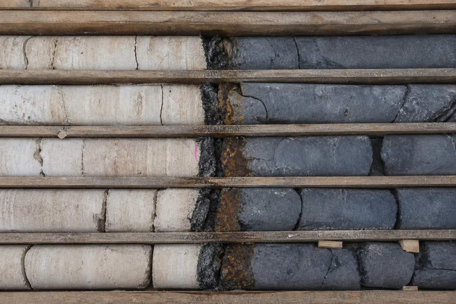
There are fault surfaces smooth enough to catch on a fingernail, and zones of broken rock broad enough to disappear beneath a boot.
They are not empty cracks.
They are mechanical and chemical boundaries.
Rock that has slipped, fractured, ground itself into gouge, admitted fluid, grown minerals, sealed, and sometimes moved again.
One mapped feature can include a 1.5 m fault core and a 30 m damage zone. A line on a map can represent all of that.
Or almost none of it.
At the basement-cover margin of the Athabasca Basin in northern Saskatchewan, that distinction is not academic. The margin is a place where cover, basement and structures have to be considered together.
Whether a particular fault was open during a relevant fluid event, whether it was later reactivated, and whether mineral fill reversed its role are separate questions.
The corpus does not establish those particular Athabasca histories. It does establish why the questions cannot be skipped.
Faults are called conduits.
They can be.
The less convenient version is that a fault is a changing architecture.
Stress determines which planes can open or slip.
Mineral fill changes apertures.
Later movement can connect an old pathway to a new fracture network, or crush and seal what had been open.
The same structure can focus flow in one interval and block it in the next.
Everything downstream depends on that conditionality.
A map line is smaller than the structure
At a scale of 1:10,000, a millimetre on paper represents 10 m on the ground. An imprecise dip estimate can move a projected contact by tens of metres, depending on depth and topography.
That is before the fault has been assigned a hydraulic role or a mineral history.
The geometry has to be made visible.
Structure contours test a planar surface.
Parallel, evenly spaced contours support constant dip.
Changing spacing indicates curvature or variable dip.
A cross-section then asks whether dips, cutoffs, thicknesses and separation can exist in the same three-dimensional arrangement.
This is not cartographic housekeeping.
A fault trace is the line where the structure reaches the surface. A fault surface is an inferred plane or curved volume at depth. A fault zone can be tens of metres wide while the line symbolizing it is a fraction of a millimetre.
The line is an assertion with a scale attached.
In excavation, the scale becomes immediate.
Mapping distinguishes a fault core, a damage zone and separate joint sets because each behaves differently.
A one-metre change in a stope wall can move dilution across a narrow ore contact. A persistent discontinuity dipping out of a pit wall can become a sliding surface. A water-bearing fracture set can become an inflow problem.
The mapped fault has not changed.
The decision has.
Stress chooses the available opening
Rock under equal principal stresses experiences mean stress and no differential stress. Once the three principal stresses differ, planes inside the rock receive different combinations of normal and shear stress.
Failure becomes directional.
Extension fractures tend to form perpendicular to the least principal stress. Idealized conjugate shear fractures commonly meet at about 60° and intersect parallel to the intermediate stress. En-echelon joints or veins form at a characteristic angle to a developing fault.
These are consequences of a frictional model.
They are not a stencil to lay over every outcrop.
Material matters.
So does fluid pressure.
So does the pre-existing plane.
Stress does not act on a map symbol.
It acts on a particular surface, with an orientation, a roughness, a cohesion, an infill and a pressure condition. A later stress field can find a weakness in an older foliation, a vein, a fault core, or an intersection of them.
It need not create a new fracture where the rock is strongest.
In a USGS study of a Colorado district, permeability enhancement followed pre-existing foliation and fold axial planes under a compression direction estimated from regional models.
That is an orientation-specific result from one district.
It is not a universal preference for structures of one compass direction.
There is no privileged azimuth.
There is only the stress field, the rock, and the structure already there.
Permeability belongs to a history
The word fault conceals different hydraulic components.
A fault core can impede cross-fault flow while the surrounding damage zone channels fluid parallel to the structure.
Fault breccia and open joints may transmit water.
Clay-rich gouge may seal it.
A tight joint can have an aperture of 0.1 mm.
An open vein can be several centimetres wide.
A fracture set may carry fluid readily along its trace while an adjacent sealed core blocks flow across it.
None of those observations licenses a single transmissivity value for the whole mapped trace.
An opening of a millimetre can carry fluid.
Mineral growth can progressively narrow it.
Early alteration can strengthen and seal a pathway.
A later pressure change can reopen the filled fracture, or divert the next fluid pulse into a different set of cracks.
The ore stage may occupy a different structure from the alteration that made the host rock receptive.
So the relevant property is not merely permeability.
It is permeability through time.
That has a direct consequence at a basement-cover margin. The present geometry of a fault can justify a hypothesis about possible connectivity. It cannot establish that the fault was open when a particular fluid moved, or that it stayed open after mineral precipitation.
A present-day aperture is not a record of a past fluid event.
Displacement rearranges before it redirects
A fault is also an ordering device.
It juxtaposes packages that were once separated.
A normal fault may place younger hanging-wall strata against older footwall strata.
A thrust may repeat a section.
Strike slip can move a contact laterally without much vertical separation.
Folds can make the same map look repetitive for a different reason. An upright synform with beds dipping inward on both sides puts the same unit on two limbs. The pattern predicts a hinge and a reversal of dip direction. It does not prove a syncline unless facing or age establishes younging.
The distinction matters because an apparent offset is separation in a chosen view.
It is not automatically net motion.
The same marker displaced a hundred metres in map view can result from several slip vectors. A folded marker can indicate a buried fault and cannot by itself supply displacement in metres. Contact geometry, cutoff relations and a balanced section do that work.
Later motion adds another layer.
A 50 m separation of an ore contact after mineralization changes mineable geometry without identifying the structure that localized the mineralization in the first place.
The fault can control the present ore outline and have played no part in the original fluid route.
Spatial association is evidence.
It is not a history.
A corridor becomes a target by narrowing
Structural geology becomes operational when it changes the next decision.
A regional fault corridor, shear zone, fold belt or inherited basement boundary can identify long-lived architecture. A wide alteration corridor is still not a drill target.
It has to be reduced to a testable trap.
A fault intersection.
A relay zone.
A bend, a jog, a splay.
A fold hinge.
An extension-vein limb.
A lithologic contact.
A competence contrast.
The target needs a reason that can fail.
A named direction and a buffer distance are not that reason.
The evidence is deliberately heterogeneous.
Field teams map faults and fabrics, measure orientation and density, sequence veins where possible, model opening under a stated stress field, and compare the result with alteration, geochemistry and geophysics.
Core orientation, televiewer images, packer tests and water-level responses connect the geometry to measured hydraulic behaviour.
Each measurement has a support.
A core touches an interval.
A televiewer records a borehole wall.
A packer test samples a section of hole.
A surface trace records an exposure.
None is a substitute for the others.
This is why a model has to keep its uncertainty.
An exploration model may display a kilometres-wide corridor.
A resource model needs surfaces that offset or repeat ore controls. A mine plan needs domains at bench or stope scale.
A section carrying hundreds of metres of unexposed projection should not look like an exposed contact. The same regional interpretation cannot simply be copied into each product.
Reactivation makes an old structure present
An old discontinuity can fail more readily than intact rock, when its orientation, friction, cohesion and fluid pressure suit a later stress field.
This is reactivation.
It joins episodes without collapsing them into one.
An early reverse fault may later move normally.
An old vein may be reopened.
An earlier foliation may become a pathway under a new stress state. A modest change in foliation orientation across a competent bed can matter more to a local opening than the regional average direction.
The record can therefore hold conflicting indicators that are sequential rather than mistaken.
Earlier mineral fill may be offset.
A sealed barrier in one formation may leak where later fractures cross it. A mineralized structure may have been disrupted after the mineralization it appears to explain.
This changes the practical cascade.
A structure first affects target selection.
It then shapes drilling orientation, and the confidence assigned to a projection. In a mine it affects wall stability, support, dilution, caving and water control. In a groundwater model it affects well placement and monitoring.
The same connection that improves production can create an unwanted inflow, or connect contamination to a protected aquifer.
The first-order effect is mechanical.
A plane opens or slips.
What follows is a connected system.
The rock cycle removes the cleanest evidence
Structural interpretation is not performed on an intact archive.
Uplift exposes rock.
Weathering breaks it down or dissolves it in place. Erosion entrains and transports the product by water, ice, wind or gravity.
Deposition preserves some material.
Burial compacts, cements or metamorphoses what remains.
Rock properties, joints, water and exposure conditions send different materials down different paths through the same landscape. At Paterson, basaltic support has stayed essentially unchanged under flowing water while adjacent limestone and shale erode more readily.
The scale can be far larger.
The Laurentide and Cordilleran ice sheets exceeded 10,000 ft in places. Such ice abrades bedrock, transports sediment and rearranges drainage.
An unconformity is not blank space in a story. It is positive evidence that non-deposition, erosion or both removed part of the record.
Deep time sharpens the problem rather than solving it. Individual zircons in younger Western Australian sedimentary rocks reach ages of 4.3 billion years, and their original source rocks are not known.
Numerical time organizes comparison.
It does not supply a continuous record of a fault’s opening, sealing and reactivation.
Earth keeps paths, fragments and overprints.
It does not keep a transaction log.
What don’t we know?
At the Athabasca basement-cover margin, the responsible questions are specific.
Was a given structure open during the relevant fluid event?
Under what stress state?
Did an earlier or later fluid precipitate material that sealed it? Did reactivation reopen that seal, cut it, or make a different pathway more important?
The corpus does not answer those Athabasca questions.
It sets the conditions for answering them.
Geometry, stress, material response, fluid behaviour, relative sequence, observation support.
A primary structural history has to establish the rest.
Several histories can leave a fault, an alteration halo, a mineralized segment and a present-day fracture network in the same place. The difference between a pathway and a barrier may be a difference in time, not a difference in location.
This is why structural interpretation is both necessary and conditional. No target, mine design or groundwater model can ignore faults and fabrics.
None should treat their present shape as a permanent hydraulic verdict.
A fault can be a flow path.
Until stress, chemistry and time make it a barrier.