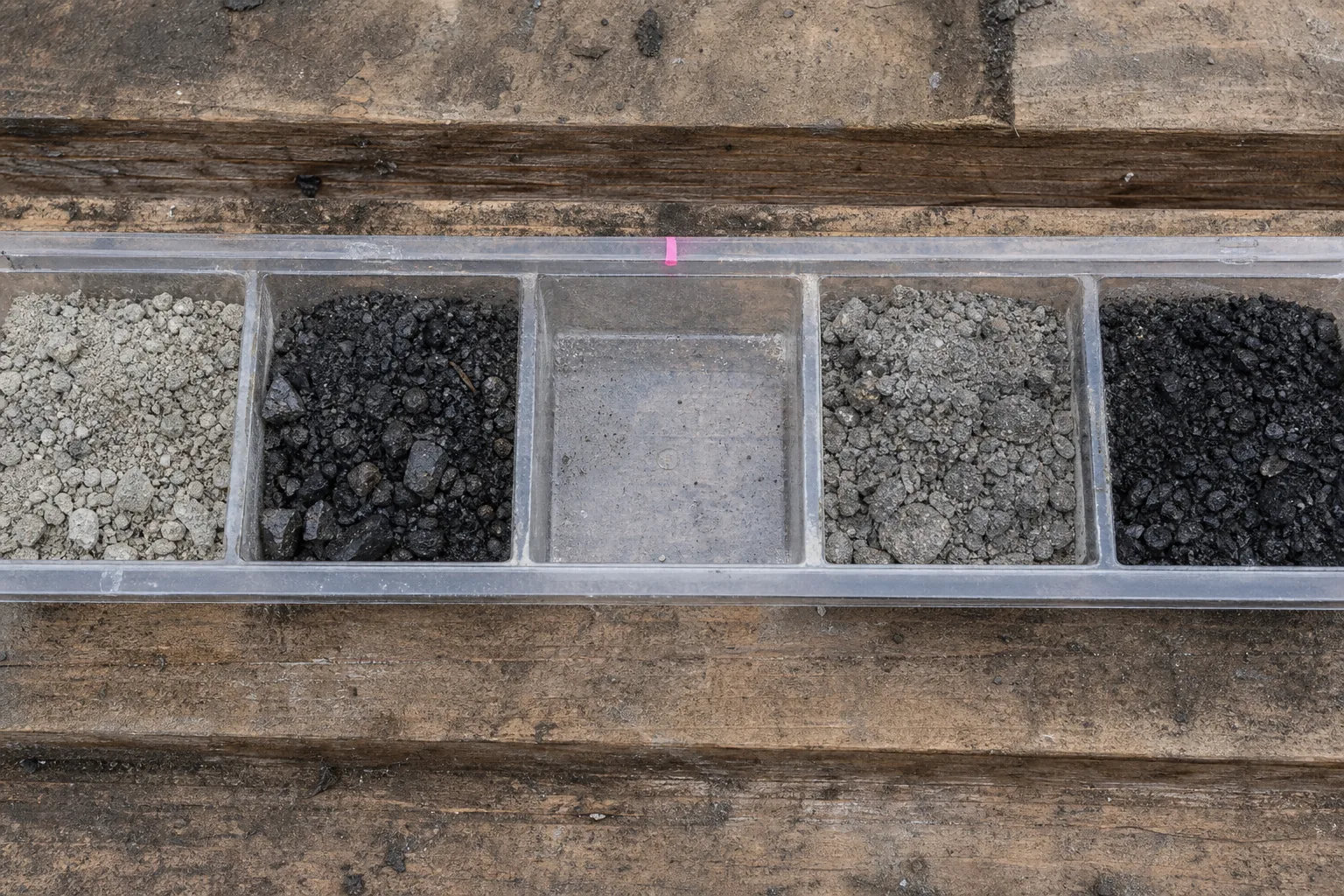
In a core shack, a length of drill core is cut along its axis and divided into intervals.
Not as a moment of revelation.
Not as a symbolic encounter with an orebody.
One half may be sampled and assigned a collar, a depth, a bag number and an assay certificate.
The other half stays as record.
The sequence turns a piece of rock into a number that can be found again.
It does not make the number the deposit speaking directly.
At an Athabasca Basin uranium programme in northern Saskatchewan, that distinction begins long before a resource table exists. A field crew records where a sample came from and what it is.
A laboratory reports an analysis.
Geologists place the interval on a section. A database joins the collar, survey, log, photograph, sample and certificate. A model then joins observations across ground no drill has touched.
The rock is there.
The estimate is an argument about it.
The argument becomes consequential when it crosses into public disclosure. Under NI 43-101, an issuer can turn a technical conclusion about a material property into written information for investors.
The conclusion then has to survive a different test. Not only whether it is plausible, but whether the record, the responsible people and the category support the exact claim made.
That is not a change in geology.
It is a change in what the geology is allowed to mean in public.
Exploration narrows without finishing
The familiar story begins with a promising hole and ends with a resource. It is attractive because it makes discovery sound like a conveyor belt.
Exploration is not a conveyor belt.
It begins by selecting a search space. Maps, historical work, geophysics, geochemistry, access, land status, known analogues, and a statement of what would make the ground favourable.
Reconnaissance then asks whether that regional hypothesis survives contact with the ground. Target generation converts the surviving evidence into a ranked list, with expected signatures, contradictions, geometry, and a test capable of changing the ranking.
The scale of the sampling changes with the question. A national geochemical survey can work at one site per several thousand square kilometres. A detailed airborne survey can fly production lines a couple of hundred metres apart. Neither density is a rule for a property.
What they explain is why a map has the resolution it has.
Only then does drilling test the highest-value uncertainty: mineralization, host, alteration or controlling structure at a predicted depth and orientation.
A collar and azimuth should be able to distinguish credible alternatives. If the first hole can invalidate the geometry, drilling the whole grid before looking at it is not confidence.
It is a refusal to learn.
The Star-Copper Creek programme in the exploration record ran six diamond holes after soil, airborne and induced-polarization work.
Six is not a verdict.
It is an example of staged work.
One hole may support a step-out.
Another may show the host exists but mineralization does not. A third may hit a fault or cover that changes the target itself.
A negative hole with known geology is not nothing.
It is evidence against a particular story.
A sample keeps its history or it is not evidence
The core interval does not explain itself.
Its evidentiary force depends on provenance.
Where it was taken, what medium it represents, how it was collected, how it moved, how it was prepared, what method measured it, and whether the resulting number is comparable with the next number.
This is why a chain of custody runs from field book to bag, shipment, laboratory certificate, database and map point.
An assay without a defensible location or sample medium cannot responsibly rank a target, however high the result looks. Precise decimal coordinates added later do not repair an uncertain historic collar.
A tidy database can preserve an old uncertainty with exceptional clarity.
The measurements have to be examined as measurements. Sample mass, horizon and collection method are part of what a value represents. A result cannot be separated from the material and the procedure that produced it.
Quality control divides the problem further.
Blanks look for contamination.
Certified reference materials test accuracy against assigned values. Field, coarse and pulp duplicates expose variation introduced at collection, preparation and analysis. Umpire work asks whether another laboratory agrees. Detection limits, digestion and over-limit procedures have to fit the expected concentration range.
None of this makes uncertainty disappear.
It gives uncertainty a place to show itself.
After a hole, the drill data has to return to the prediction that justified it. The controlled database receives collars, surveys, logs, photographs, samples and assays.
Sections, plans and three-dimensional views change.
CIM’s exploration guidelines call for sections, plans and longitudinal projections to be updated as holes are completed, and for final databases and views to be archived after each phase.
That procedure distinguishes a hole miss from a model miss. A predicted host with no mineralization weakens the mineralizing-control hypothesis. Unexpected cover may instead mean the collar or the target geometry was wrong.
A mineralized interval still needs its geological context, grade distribution, continuity implication and analytical reliability before it earns a step-out.
The difference is not paperwork.
It is what keeps the best interval from becoming the whole story.
Continuity is inferred, not sampled
At appraisal the question changes.
The programme no longer asks only whether mineralization occurs. It asks whether a three-dimensional volume, a grade distribution and a technical setting can be constrained well enough to carry a resource estimate.
That takes density, mineralogy, geotechnical and hydrogeological domains, metallurgy, waste characteristics, access, infrastructure, permitting and social constraints alongside the drilling. Faults, barren intrusions, alteration fronts and grade domains matter because they interrupt or alter continuity.
More close-spaced drilling is not itself the answer. Spacing is a confidence question, and the answer varies with geometry and evidence.
Natural Resources Canada uses fifty metres across and a hundred metres along a planar gold-vein structure as one boundary example between mine-site exploration and development.
The guideline gives different distances for other geometries.
It is not a universal prescription.
Treating it as one would mistake a jurisdictional reporting distinction for a geological law.
The same restraint applies to a significant intersection. A modest gold grade over a modest tonnage, or a percent-level copper grade over a similar tonnage, normally does not establish a deposit of potential economic interest outside a favourable mine-site context.
Grade and tonnage are not portable verdicts. They belong to a model, a setting and a decision.
This is where a resource estimate stops being a numerical summary and becomes a controlled claim. The estimator uses observations, domains and assumptions to estimate tonnes and grade.
But the unsampled ground has not been converted into direct knowledge. It has been constrained to a degree the team has to describe honestly.
The public categories are the record of that degree.
A category is confidence, not a mine
CIM defines three resource categories.
Inferred carries the lowest confidence.
Indicated carries enough confidence to apply modifying factors in enough detail for mine planning and economic evaluation.
Measured carries the highest.
They are not three mineralogical states.
The rock does not become Indicated after a press release. What changes is the support available for a specific estimate: geological understanding, sampling density, continuity, quality control, and the model’s ability to represent them.
A block that cannot bear the higher-confidence claim does not improve because a development case would be easier to finance.
Reporting systems make the boundary explicit.
The CRIRSCO family supplies common concepts across national systems without being an international regulator. JORC frames public reporting through transparency, materiality and competence.
The United States framework under Regulation S-K 1300 sets its own disclosure components for material mining properties.
The forms and legal triggers differ.
The discipline does not.
Exploration Results are observations and data.
A Mineral Resource has reasonable prospects for eventual economic extraction. A Mineral Reserve is the economically mineable part of an Indicated or Measured Resource after modifying factors have been applied.
An Inferred Resource does not convert to a Mineral Reserve at all.
That prohibition is not an insult to inferred material. It is a boundary against letting uncertainty vanish inside a cash-flow narrative.
CIM likewise allows an Indicated Resource to convert only to a Probable Reserve, while a Measured Resource may become Proven or Probable depending on uncertainty in the modifying factors.
Categories are not optimism measured in tonnes.
They are limits on what a public number may imply.
The filing clock makes it answerable
For a maiden resource disclosure on a material property, NI 43-101 may permit the announcement before the supporting technical report is filed.
The support cannot be an afterthought.
The ordinary filing deadline is 45 days after disclosure.
That window has a plain implication.
By the day of the announcement, the responsible technical work has to be far enough advanced to support what the market receives.
The later report may be fuller.
It cannot be a retrospective attempt to find out whether the headline was defensible.
The record carries an effective date, a data freeze, property boundaries, currency of site work, and Qualified Persons responsible for separate sections.
It carries the drill-hole database, collar surveys, assay certificates, quality control, density work, geological interpretation, domains, compositing, variography, estimation method, cut-off rationale and reasonable-prospect assumptions. It explains data verification rather than asserting reliability.
There is normally a personal inspection before a technical report is filed. An early-stage property can have a seasonal-access exception, but the omission, its reason and the intended timing have to be disclosed, and the inspection completed as soon as practical.
The visit is not ceremonial.
It connects drill sites, core storage, access and operating context to the record being relied on.
Each Qualified Person’s certificate names identity, report and date, qualifications, inspection, responsible items, independence, prior involvement, and an affirmation of compliance and completeness. The consent permits filing and use of extracts. These documents give the claim a name, a scope and a version.
If the filed report differs materially from the announcement, the issuer reconciles the difference. If a review identifies deficient material, the corrective sequence escalates: correction or removal, a clarifying or retracting release, and ultimately consideration of a cease-trade order.
The securities document does not discover the rock.
It makes the claim answerable.
What don’t we know?
The unresolved question at an Athabasca exploration programme is not whether the core is real.
It is real.
The collar, depth, interval, assay and record can establish that a particular sample was collected and measured.
The hard question begins beyond the interval.
Does the available drilling constrain continuity well enough for the proposed classification? Are the samples representative and their locations secure? Do blanks, reference materials, duplicates and umpire work support the analytical record?
Does the geological model explain the misses as well as the good intersections? What does the unsampled ground do to the model?
No reporting category can manufacture the missing observations. It can only state, under a defined system, how much confidence the existing record supports.
That is why a maiden resource is neither a revelation nor a promise. It is the moment a geological inference accepts a public burden: a category, an effective date, a responsible person, a technical report and a deadline.
The orebody stays in the ground.
The estimate is a controlled claim about it.