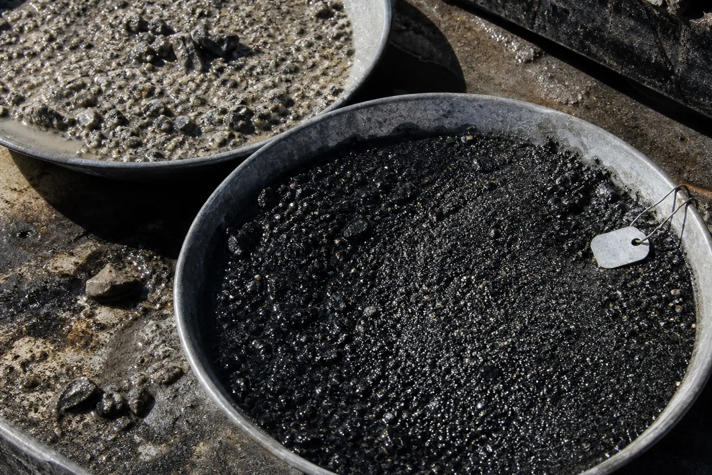
A stream-sediment sample is wet grit in a paper bag.
It may carry grains from bedrock, material adsorbed to clay, fragments released by weathering, and whatever a drainage has collected between an uncertain source and the sampler’s hands.
It is not ore in a bag.
In a regional geochemical survey of the Athabasca Basin in northern Saskatchewan, that distinction is the beginning of the work.
A coherent group of elements can be real.
It can be spatially organized.
It can be consistent with the fluids, alteration and structures expected of a target system.
It still has to travel.
A pathfinder anomaly is said to point to ore. The phrase is useful because it contains a direction. It becomes misleading when direction is mistaken for arrival.
A pathfinder suite is evidence of a system. The system may be the one sought. It may be a different mineralizing system, an altered lithology, transported cover, contamination, or a process the original model did not include.
The sample preserves an effect.
The programme is trying to infer a cause.
That is an inverse problem.
An element needs a job
No element is inherently a pathfinder. It becomes one inside a stated geological proposition. A particular deposit style, expected minerals, an alteration assemblage, a transport environment, and a direction in which the observation might change toward a source.
Partitioning is the physical reason that proposition can work. As minerals crystallize, alter or interact with fluids, they preferentially accept some elements and reject others. The remaining melt or fluid changes composition.
Under the right temperature, pressure, pH, redox or mixing condition, a later mineral assemblage can carry a suite quite different from the bulk rock that supplied it.
Laboratory partition coefficients show why this is more than a verbal association. Zircon strongly concentrates the heavy rare earths from a coexisting liquid. Apatite concentrates rare earths less sharply but still selectively.
A mineral phase can therefore record a selective history that whole-rock chemistry averages away.
That does not make every chemical enrichment a target.
In experiments on fluorine-rich topaz rhyolite, high melt fluorine drove a fluid phase capable of carrying molybdenum, tungsten, tin, lithium, beryllium, rubidium, caesium, uranium, thorium, niobium, tantalum and boron.
That result identifies possible transport.
It does not permit an exploration map to convert fluorine directly into any one of those commodities.
The difference is the model.
A target suite has to be predicted before it is admired.
A USGS gold study found 90 to 100% overlap between mapped gold anomalies and five selected element distributions. Tellurium had the broadest footprint and was proposed for reconnaissance. Tin, bismuth, silver and manganese were more restricted and useful in detail work.
The useful result is not a universal shopping list of pathfinders. It is a division of evidential labour inside one geological setting.
One element makes a broad footprint.
Another sharpens the question.
Neither has become ore.
Two media can disagree honestly
Drainage is not a transparent pipe from bedrock to map.
It is a filter.
Fine sediment can retain a dispersed dissolved or adsorbed signal. A panned concentrate emphasizes dense, resistant mineral grains. Grain size, hydrodynamic sorting, weathering, adsorption and mineral durability decide what reaches each fraction.
The same source can therefore appear differently in different media.
A southern Alaska comparison took two primary products at every selected stream site: stream sediment and panned concentrate. Sediment was separated into coarse sand, fine-to-medium sand, and silt-to-clay fractions. Concentrates were divided magnetically for some analyses. The study found silt-to-clay sediment plus panned concentrate most efficient in that setting.
Its negative result matters as much as its preferred method. No stream-sediment fraction identified gold-vein anomalies, despite low detection limits.
An absence had not become a geological absence.
This is why independent coherence carries weight. If a fine fraction and a concentrate give compatible spatial evidence, two different transport filters have arrived at a compatible inference.
If they diverge, the divergence can identify the filter. Perhaps the signal travels as a fine dispersed phase.
Perhaps as a dense mineral.
Perhaps not through that drainage at all.
The wrong response is to average the disagreement into one reassuring number.
National surveys retain both coarse and fine size fractions and record pH and particle size. Those details are not laboratory ornament. They are possible explanations for a concentration.
A high number without its medium, grain-size fraction, sampling horizon and local background is an observation stripped of the conditions that made it.
This is especially severe under transported cover. A real anomaly can be sourced by target mineralization, local lithology, glacial or slope dispersion, agriculture, historic mining, road dust, a different sample horizon, or an analytical artefact.
The map does not announce which.
It cannot.
A coherent pattern has rivals
The most convincing anomaly is often the one most at risk of rhetorical inflation.
Several elements rise together.
The pattern has a shape.
The shape agrees with an appealing deposit model. A target has become legible enough to fund.
That is progress.
It is not confirmation.
At Baker Creek, anomalous molybdenum, zinc, silver and lead occurred in at least half of the sampled media. The combined silver, gold, arsenic, antimony, thallium and manganese pattern suggested epithermal mineralization. A subsequent 1,530-foot hole confirmed a bedrock source for anomalous silver and base metals.
It did not confirm economic molybdenum.
That sequence is not a failed geochemical survey. It is a successful reduction of one uncertainty, followed by the survival of another. The anomaly was evidence of a mineral system. The assumed commodity value had not survived the next gate.
The distinction is between source and significance. A drillhole can show that a signal is not merely transported surface material. It cannot, without more evidence, establish average grade, true width, continuity, metallurgy, density, geotechnical conditions, water requirements, infrastructure, permits, land agreements or finance.
Each of those questions has a different support.
Grab samples make the danger visible. A programme can log dozens of rock grabs, mapping and short holes before any diamond drilling. Such samples can identify mineralization or alteration. They are selective observations, not an estimate of average grade or continuity.
A collection of them can make a compelling map and remain a poor basis for a resource proposition.
The signal is real.
The claim can still be too large.
Isotopes constrain a source
Isotope systems appear to offer an escape from that ambiguity, because they describe a material history rather than an elemental association.
Hydrogen and oxygen can constrain precipitation-derived recharge, evaporation, mixing and water-rock exchange. Carbon, sulphur, lead, strontium and neodymium can constrain source or reaction pathways where end members are separable.
Everything turns on that last clause.
A long-running precipitation compilation across the Colorado Plateau contains thousands of weekly composite samples over two decades, and a wide oxygen-isotope range across its sites. That is a baseline lesson before it is a number. Natural water has a field, a seasonality and a geography.
An isolated isotope result cannot announce that a mineralizing fluid was magmatic, meteoric or metamorphic. It has to be compared with local precipitation, elevation, season, water-rock exchange, mineralogy, fluid inclusions, and the other records a geological model predicts.
Isotope evidence can narrow a source question sharply. It cannot manufacture a unique source where different histories overlap in the same field.
The deeper discipline is the same as for a pathfinder suite. An element association, an isotope ratio and a structural interpretation may each support a model.
They are not interchangeable votes.
They arise from different materials, processes and scales.
Their agreement is powerful precisely because it is independent.
Their agreement is not immunity from a shared bad assumption.
The survey can fail first
An empty map is not always an empty landscape.
False negatives begin in survey design. Lines may be wider than the feature, or run parallel to a narrow trend, or cross unsuitable sample media, or leave the most informative ground inaccessible. Detection limits can be too high. Covered ground can be treated as residual soil. Sparse data can be interpolated until the map looks more certain than the acquisition ever was.
One Alaska airborne programme flew most of its area at a wide line spacing, infilled a single block at half that, and recorded mean ground clearance varying by hundreds of metres between blocks.
The variation is not a defect by itself. It is a warning that apparent map precision has an acquisition history.
Resolution can also be excessive.
Dense sampling may return many local highs when natural variability overwhelms the target signature. Each new high consumes mapping, access, analytical and interpretation money.
The programme becomes very busy while learning little about the feature that matters.
This is why an orientation phase has two tasks. It asks whether the method can detect a plausible signal. It also asks whether it can distinguish that signal from background.
The evidence begins before the assay certificate.
Money follows what has been ruled out
Exploration does not buy ore.
It buys the next decision.
At reconnaissance, claims, data compilation, community engagement, mapping and sampling purchase the right to reject broad areas cheaply. A suite that coheres across media and geology can justify infill or a new method.
A survey that has not separated target from transport, lithology or contamination has not earned expensive drilling merely because its colours look persuasive.
The national spending pattern shows the gradient of commitment. In Canadian exploration and deposit-appraisal accounts, diamond drilling takes about two-fifths of the total, several times the combined spend on geology, geochemistry and geophysics.
Those are national categories, not a price card for an Athabasca programme.
Drilling combines crews, fuel, access, water, casing, directional surveys, core handling, assays and demobilization. Its proper economic measure is information per metre. A short hole that distinguishes two high-value models can be worth more than a long programme that repeats the preferred one.
The same accounts record substantial sums for mineral leases, claims, line cutting, head office, environment and land access. A target does not move directly from chemical map to drill collar. Access, agreements, data management, baseline work and logistics can determine whether the geological test exists at all.
Later, even a discovery moves the spending boundary again. Engineering, economic and feasibility studies can outspend rock work outright.
The ground has not changed.
The question has.
From whether a source exists, to whether a mineable proposition can survive representative metallurgy, geotechnics, hydrogeology, mine design, processing, infrastructure, permitting and finance.
The first sample costs little.
The claims it cannot yet support are expensive.
What don’t we know?
The regional Athabasca sample can contain a coherent suite. Two media may give compatible spatial evidence. Isotope work may constrain a source question. A geological model may predict the alteration, structures and transport route that connect them.
What stays unknown is whether the signal comes from the target system, from transported cover, from contamination, from lithology, or from an untested process. Whether the sampled drainage preserved or diluted the relevant path. Whether a drillhole will cross the source rather than only its halo.
Even a bedrock source does not end the uncertainty. The World Gold Council says fewer than one in a thousand prospected sites become productive gold mines. Industry datasets report far higher conversion rates for selected significant discoveries.
The figures look incompatible only while their denominators stay concealed.
Most areas do not generate a credible target. Most targets do not yield an economic intersection. Most intersections do not define a deposit. Some deposits do not secure development.
For mines that began production between 2010 and 2019, the IEA found an average of more than 16 years from discovery to first production. More than a decade of that was exploration and feasibility, and the rest construction.
Those are not a timetable for a particular prospect. They describe how many uncertainties can remain after geology has done enough to justify a name.
A pathfinder suite is valuable because it gives uncertainty a direction.
It does not make the direction a discovery.